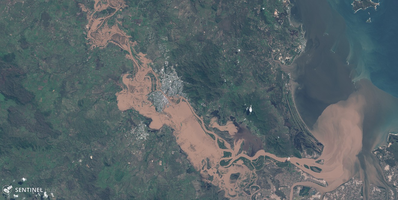
The Google Earth Blog spotted the recent Queensland floods in Sentinel-2 imagery.
The Sentinels provide systematic coverage of the land areas, which facilitates the detection of changes due to natural hazards. Hence we can compare this Sentinel-2A image with another one that was captured last year during the same season to better highlight the extent of the flooded areas.
