The giant Kurbu-Tash landslide in Kyrgyzstan occurred on 23-24 April 2017 and was highlighted by Dave Petley in the landslide blog of the American Geophysical Union.
Please read the erratum: https://labo.obs-mip.fr/multitemp/?p=10566
The landslide can be seen in a Sentinel-2 image acquired 5 days after the event. I used a near-infrared composite to increase the contrast between the vegetation and the bare soil.
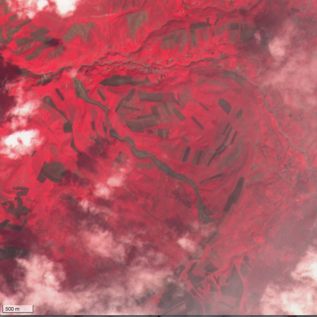
I used this image to estimate that the length of the landslide is about 3.5 km [1]. The volume of the landslide was estimated to 2.8 million cubic meters by AKI press [2]. Local news reported there were no fatalities, but 5 days later, another landslide in Ayu village killed 24 people. I think that this landslide is also visible in the same Sentinel-2 imagery although it is less evident.
[1] Half of the length of the massive Glacier Bay landslide!
[2] This is still 20 times less than the first Aru glacier avalanche.
In fact, the pictures above show the landslide-flow Kysyk-Alma, which began to move on April 15, 2017 at 12 o’clock local time. The volume of the landslide is about 500 thousand cubic meters. This landslide formed west of the Kurbu-Tash landslide.
Dear Isakbek, thank you for your comments! I found the right landslides and wrote a corrigendum here: https://labo.obs-mip.fr/multitemp/?p=10566
In fact, the pictures below have nothing to do with the Ayu landslide, the coordinates of which are as follows:40.914546N, 73.462260E