 =>
=> 
Bonne année !
A fifth season starts for the « Time series » blog (2016 stats are provided at the end of the post) ! We wish to all our readers that 2017 :
- will be very happy, exciting, in a good shape, in a peaceful context,
- with a lot of blue skies and nice satellite images abbove your sites,
- with a successful launch of Sentinel-2B et a fully operational system,
- with (really, even if it’s hard to believe) Venµs launch and images every second day on 100 sites,
- with a Muscate ground segment that produces lots of Sentinel-2 L2A data (production start was slow and unstable, but it seems the reason was found and corrected),
- with new products at Theia : a Snow cover product, and land cover maps of France
- hopefully with powerful new public cloud servers, to process the data next to them, and avoid downloads and data duplications, in an open source way, and not under private APIs
- with a new French government, that will increase again public research budgets and will not decrease the number of civiil servants, that make this blog exist
- and a new American government, that will NOT fulfill its commitments, and among other things, will not come back to data protectionism. The openness of Landsat or Sentinel data is a game changer for remote sensing, and makes our work really useful.
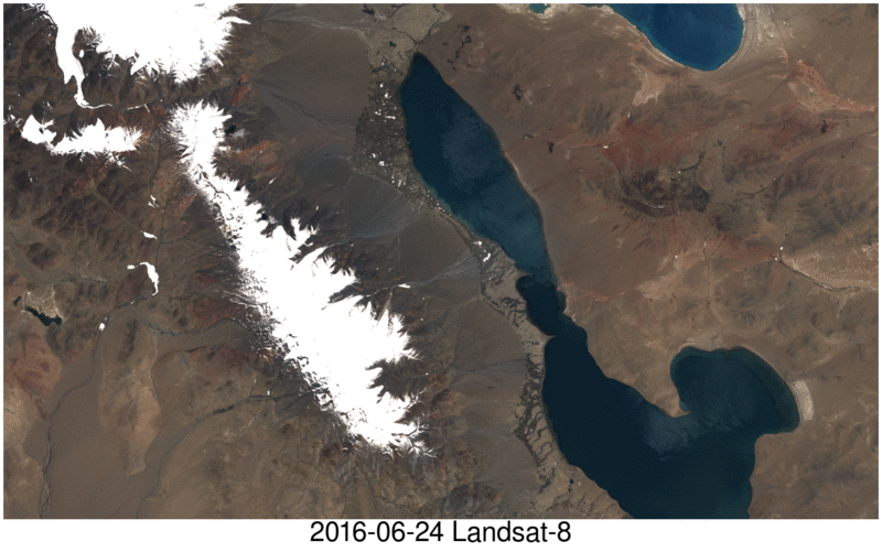 Sequence of two Landsat-8 and Sentinel-2A images. Both images are level 1 product displayed as natural color composites. Click to enlarge.
2016 Blog stats
| 2013 | 2014 | 2015 | 2016 | |
| Number of visits | 13985 | 22928 | 34723 | 47773 |
| Number of pages read | 30922 | 46940 | 66947 | 89555 |
2016 was a new year of exponential increase of the blog audience, thanks to a lot of new authors :
- Simon Gascoin scores of nice posts, and especially the saga around the glacier avalanches in Tibet, or how this blog (and the Sentinel satellites) nearly saved lives (yes, really !)
- the posts on water and agriculture from Florian Helen, Michel Le Page, Marjorie Battude and Isabelle Soleihavoup,
- the first land cover maps over the whole France automatically produced from Landsat data, released by Jordi Inglada and his team.
- the results from Pierre Alexis Herrault in Siberia (it was not a punishment) on dissolved organic matter in the rivers, or on forest fires
- the discussions on google earth engine, and the associated risks
- the demonstration of Sentinel-2 like data capacity to recognize tree species (from David Sheeren)
- the nice results from MACCS, and the difficult start of MUSCATE ( but now, it seems to work at full speed)
- we would have liked to get news from the microwaves team at CESBIO, but they seemto be a little shy
This blog is open to new authors, writing a post can be done quickly (especially the second and third ones…), and you don’t even need to be part of CESBIO to contribute. Here is the ranking of the most frequently read pages :
What may we conclude from that ?
- distributing small open source codes gets a large success (and a lot of questions every week…)
- crowds come to read the geophysical findings of Simon Gascoin (with a lot of advertising on social networks)
- the use case of GEE yields much more connections than the posts that warn you about the risks
- the « how it works » series are still succesful
- the 20th entry of the ranking really fascinated a German reader from Berlin with 400 connections
- the suspense about Theia’s production is still followed
Dear Professor Hagolle,I read your paper called “A Multi-Temporal and Multi-Spectral Method to Estimate Aerosol Optical Thickness over Land, for the Atmospheric Correction of FormoSat-2, Landsat, VENμS and Sentinel-2 Images”. I want to derive AOD over a lake from Landsat 7. I want to use dark target “MS” algorithm.I was wondering if I can follow dark target algorithm over ocean developed by NASA for MODIS project.Also, as this algorithm assumed that reflectance at 660 nm over the ocean is almost zero, I was thinking that I can discard the atmospheric correction in this case? Thanks,Saba