First Sentinel-2 snow map
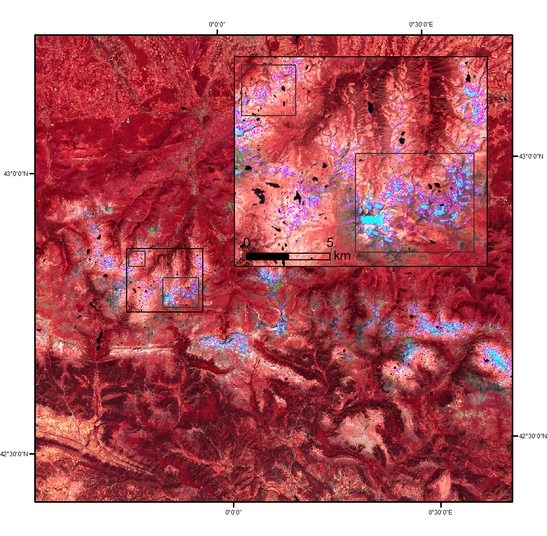
=> In the framework of the THEIA land data center, we have developed a simple but robust method to map […]
=> In the framework of the THEIA land data center, we have developed a simple but robust method to map […]
=>Dans le cadre du Centre d’expertise scientifique THEIA « surface enneigée » nous avons développé une méthode simple et robuste pour détecter […]
=> Following the irrigation scheduling experiment in Morocco during the SPOT4-Take5 experiment (Le Page et al, 2014), a Web tool […]
=> Dear reader, may 2015 bring you health and happyness !2015 should be a great year for the time series […]
=>Chers lecteurs de ce blog, que cette année 2015 vous apporte joie et santé !L’année 2015 sera une grande année […]
=> As said in a previous post, we are testing various methods of level 3A production, using SPOT4 (Take 5). […]
=> Caution ! This post contains formulas ! Aerosols play a great role in the atmospheric effects. Aerosols are particles […]
=> Land cover and land use maps Although different, the terms land use and land cover are often used as […]
=> Les cartes d’occupation du sol Mise à jour 2020 : cet article est maintenant ancien, des informations plus précises […]
=> We have now received all the L1A images of the SPOT4(Take5) experiment taken between January the 31st and March […]